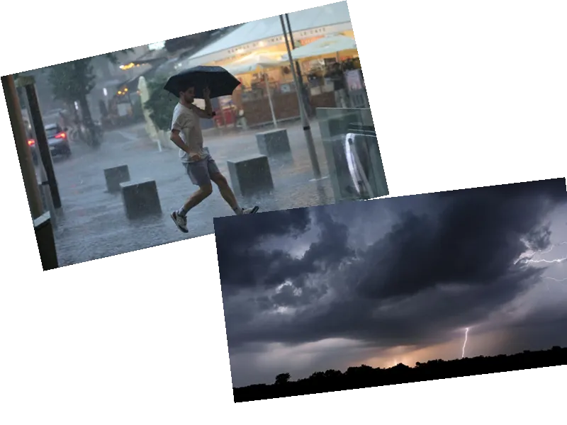
Severe Storms to Hit France This Weekend
France is bracing for a significant weather event this weekend as a strong stormy deterioration is expected to sweep across the country from the southwest to the northeast. According to The Weather Channel, the clash between cool air from the Atlantic and warm air currently present in the territory, compounded by a depression from Portugal, is creating conditions ripe for violent thunderstorms.
Saturday: Stormy Weather Across Most of France
On Saturday, June 29, more than half of France will be impacted by a wave of storms. The most severe weather, including intense precipitation, hail, and gusty winds, is anticipated in regions such as Franche-Comté, Lorraine, and Alsace, as per Météo France. Meanwhile, the northwest is expected to experience cooler temperatures compared to earlier in the week, and the extreme southeast will maintain hot and dry conditions. Residents are advised to be cautious with outdoor activities due to the unpredictable nature of the storm.
Sunday: Cooler Temperatures and Continued Weather Changes
As the storms pass, temperatures will drop significantly on Sunday, June 30, coinciding with the first round of the legislative elections. Paris, for instance, will see a temperature decline from around thirty degrees to approximately twenty degrees. Across France, temperatures will fall below seasonal averages, with the northeast experiencing almost autumnal conditions. Only the Mediterranean area is expected to remain sunny but windy. Early trends suggest that the beginning of July will continue to see cool weather, showers in the northeast, and a risk of thunderstorms in the mountains, while the weather in the southeast and near the Atlantic will be more stable.
- This Friday, June 28, France continues to experience hot and stormy weather, though cooler air has arrived in the North-West quarter overnight, making the air more breathable, especially in the capital and along the beach. The Massif Central, Northern Alps, and Franche-Comté face a marked risk of storms, according to La Chaîne Météo.
- In the morning, the weather is variable with clouds and clearings from the South-West to the East, accompanied by a few scattered showers. The north-west enjoys fine but cooler weather compared to recent mornings, while the south-eastern third remains warm, albeit occasionally cloudy around the Gulf of Lion and the lower Rhône valley.
- By the afternoon, the heavy weather triggers storms in the central massif, particularly in the mountains, and other storms break out on the Alpine and Jura ridges, potentially reaching the south of the Vosges. The north-west continues to experience fine but cooler weather, more in line with seasonal averages.
- In the evening, thunderstorms persist from the central massif to Franche-Comté, gaining momentum and threatening neighboring plains. Anticipation is required for further deterioration rising from Spain overnight towards the Pyrenees and the south of the Garonne. The northern two-thirds of the country remain dry and less hot.


